What Is Public Data and Why It Powers Modern Directories
Learn what is public data, how it differs from open data, where to find it, and why directories like Data Centers List rely on it for facility insights.
14 min read
Public data is information collected or published by public institutions and made available for broad reuse. It's not the same as open data, because public data can still carry limits on reuse or redistribution.
What is public data, really, when a single dataset can sit inside a government portal, a PDF, a map, or a directory product that people use every day? The short answer is that public data is the raw material behind a lot of modern decisions, but the legal and technical details decide how far that material can go.
Table of Contents
- What Public Data Actually Means
- The Main Categories of Public Data
- Public Data Versus Open Data and Why It Matters
- Where Public Data Comes From in Practice
- How Public Data Becomes a Living Directory
- Common Gaps and Misconceptions About Public Data
- Putting Public Data to Work Responsibly
What Public Data Actually Means
Public data is easiest to understand as information collected, produced, or published by public institutions for broad reuse. That includes statistics, administrative records, and geospatial data that support everything from budgeting to site selection, and it's one reason public information can shape both policy and markets (public data overview).
Start with the licensing question
The cleanest distinction is this, public data is about access, open data is about permission. A dataset can be available to the public but still come with terms that limit commercial use, redistribution, or automated reuse, which means a team can read it without being free to republish it (public data definition).
A useful analogy is a public library versus a lending library with special rules. Both let people enter and use books, but only one gives free rein to copy, share, and reuse the material without checking the fine print first.
Practical rule: if a dataset will feed analytics, a product, or a model, the access path and the license need to be checked separately.
Public data also includes long-running official datasets that create continuity over time. In the United States, the Census has been central since the 1940s for tracking the monthly unemployment rate, which shows how a stable public series can become part of everyday business planning (public data overview).
Why the distinction matters for non-technical teams
Teams often think “public” automatically means “safe to use for anything.” That assumption breaks fast. A dataset may be usable for internal analysis but not safe for redistribution, model training, or product embedding if the terms are narrower than open data allows (technical definition of public data).
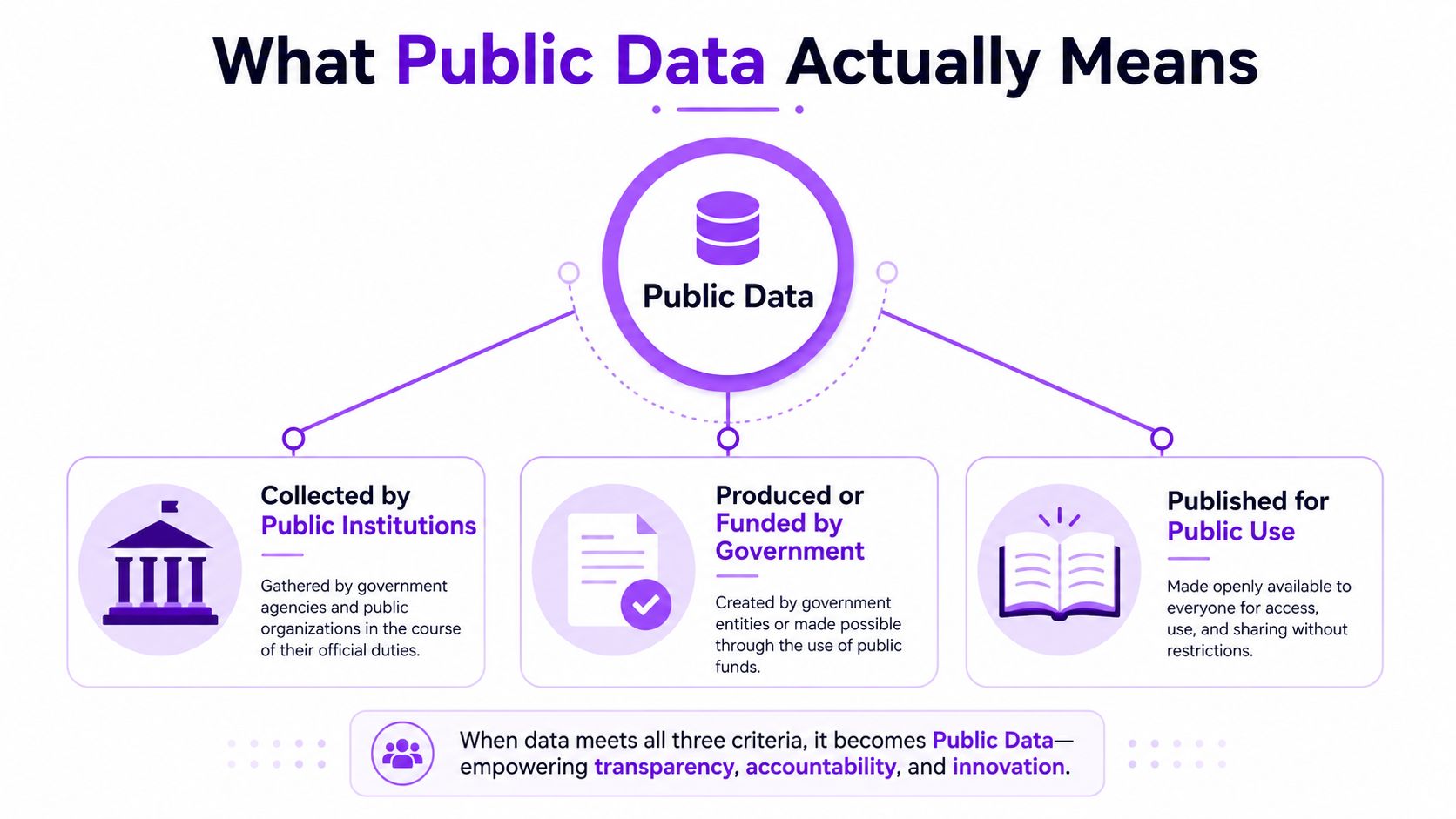
That's why public data shouldn't be treated as a vague label. It's a working category that tells analysts where the data came from, how it can be reused, and how much caution is needed before it becomes part of a workflow.
The Main Categories of Public Data
Public data falls into four recognizable shapes, official statistics, administrative records, geospatial data, and community-contributed records. A dataset may arrive as a spreadsheet, a map layer, a registry, or a file buried in a portal, but the underlying category usually stays the same. That classification matters because each type answers a different question, much like different sections of a library serve different kinds of research.
Official statistics and administrative records
Official statistics are the series many people look for first, labor, health, population, and economic data among them. These are usually built from recurring public programs that give analysts a stable view of how conditions change over time. In the United States, recurring federal statistical programs are spread across agencies, and one review estimated that 13 federal agencies spend about $3.7 billion annually collecting, processing, and disseminating this information (public data overview).
Administrative records come from the routine work of public agencies. Permits, licenses, reports, and filings all fall into this group. They are useful because they reflect real transactions and operations, the paper trail left behind when government services, approvals, and compliance steps happen in practice.
A census table tells you the counted population in a place. A permit file can tell you what happened on a specific block.
Geospatial and infrastructure data
Geospatial data ties information to location. Maps, utility grids, planning files, and zoning layers all fit here, and they become more meaningful once the address, parcel, or boundary is part of the record. A permit in one neighborhood can point to a very different story than the same permit in another part of town.
That location context is why planning files, utility maps, and public infrastructure registries matter in market analysis. They help analysts connect an address to the physical world around it, which supports site selection, resilience planning, and facility verification. A directory of data centers, for example, depends on this kind of public information because a listing is not just a name and a street address, it also depends on whether the site sits near the right power, transport, and zoning context.
Community-contributed public data
Not all public data starts inside a government office. Some of it is contributed by communities and then reused widely, especially in mapping and infrastructure settings. This kind of input can fill gaps that formal systems miss, which is why it often shows up in living directories and collaborative reference data, where many small updates build a more complete picture over time.
It still needs care. Analysts should check where the contribution came from, whether the record has been refreshed, and whether the information still matches current conditions. A community update can be helpful, but it should be treated like any other source that may need verification before it is used in a decision.
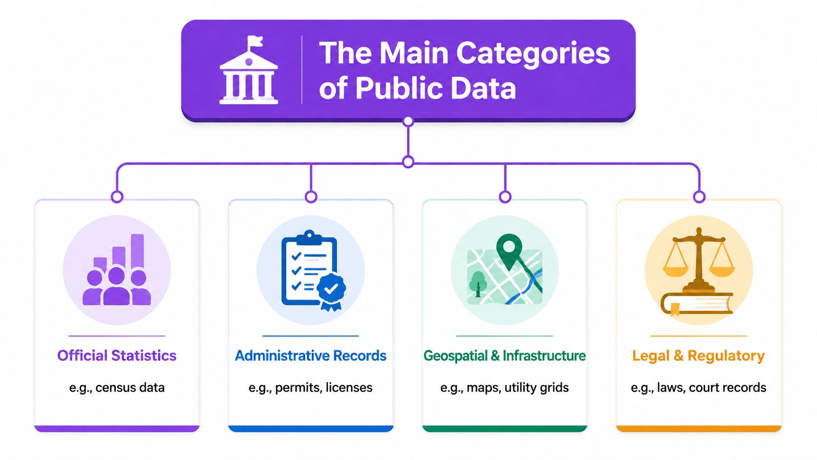
Public data becomes useful when the category is clear. Analysts cannot validate, compare, or reuse a record they have not classified.
Public Data Versus Open Data and Why It Matters
Public data and open data often get grouped together, but the difference matters in practice. Public data is information made available by an institution or authority, while open data is public data that comes with a license or policy that allows reuse, redistribution, and often machine-driven processing with fewer barriers (technical definition of public data).
Access is not the same as permission
A dataset can be public because an institution has published it and anyone can view it, yet still limit what readers may do with it. That matters for a team building reports, automations, or embedded product features, because visibility inside a portal does not automatically create permission for external reuse.
A planning document released through a public process may be visible to everyone and still require careful handling before it is copied into another system. Open data follows a different rule set. It is designed for broader reuse, so long as the stated conditions are followed.
Format changes the real-world workflow
Legal permission is only part of the picture. A public dataset that lives in a PDF or behind a request process may be difficult to automate, even if it is available to read. An open dataset in a machine-readable format is easier to ingest, normalize, and compare.
That difference shows up quickly in day-to-day analysis. A directory of data centers, for example, works best when records can be checked, refreshed, and matched across sources. If the underlying public record is locked in a format that resists reuse, the directory becomes slower to maintain, even when the information itself is visible.
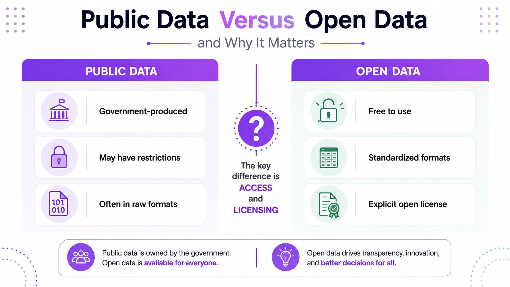
Decision test: if redistribution or model use is part of the plan, the license has to be checked before the data enters the pipeline.
The practical point is simple. Public availability does not automatically mean free reuse, and that is why analysts separate access from permission before a record enters a workflow. A dataset may help someone read the facts, but open data helps them build on those facts at scale.
The distinction also shows up in governance. Public data portals collect machine-readable datasets in one place, and open-data policy settings set the rules for how far those datasets can travel once they are reused. That separation matters because it keeps simple visibility apart from the right to reuse data in a product, report, or directory, including a live reference like Data Centers List operators.
Where Public Data Comes From in Practice
Where does public data come from, once you move past the definition and into real work? The answer is usually a mix of portals, agencies, registries, and specialist directories, each serving a different part of the same chain.
A useful way to read public data is to trace its path, like following ingredients from farm to kitchen to finished meal. The source tells you what the record can support, how often it may change, and how much caution you need before using it in a product or report.
National portals and statistical agencies
Many teams start with a national portal. These portals gather datasets from several agencies into one search layer, which saves time and makes it easier to compare records across departments. In practice, they are strongest as discovery points, not as proof that every file is equally current or equally reusable.
The UK portal is one example, and the pattern appears elsewhere too, including data.gov in the United States and data portals across the European public sector. Those sites work like catalogues in a library, because they point you to the source material and help you understand which office published it. The open-data policy context matters here as a policy reference, but the practical habit is the same, check the issuer, the update rhythm, and the stated reuse terms before you treat a file as ready for analysis.
Statistical agencies sit in the next layer. They usually publish official counts, surveys, and time series that help answer questions about labor, population, health, or the economy. Analysts rely on them because they provide continuity across years, which is often more useful than a one-off snapshot.
Geospatial and infrastructure registries
Some of the most valuable public datasets are not reports at all. They are registries of places, facilities, boundaries, routes, or infrastructure, and they become especially useful when a business needs to confirm whether a physical asset exists, is active, or is changing.
That kind of record behaves like a shared map legend. A planning file may tell you what was approved, a public registry may tell you what is officially recorded, and a community map may show what people on the ground are seeing. Put together, those layers help connect a site to a city, a region, a known operator, or a wider infrastructure network.
Specialized directories and operational APIs
Public data also appears in specialized directories that turn raw records into searchable products. A global facility directory can combine public sources, operator disclosures, and structured records into one live view, which is why it feels more like a working system than a flat spreadsheet. The operator listings show how that works in practice, by organizing assets by brand and market.
The point is not that one source can carry the whole load. Public data often moves through a chain, from raw record to verified listing to the interface people use. For market-intelligence work, that chain matters as much as the final table, because it shows where each field came from and how much confidence a reader should place in it.
How Public Data Becomes a Living Directory
How does a public record turn into a directory that people can use? The answer is a pipeline, one that gathers many public inputs, checks them against each other, and then presents the results in a format built for day-to-day work.
Raw records need curation before they become useful
A modern facility directory may begin with operator disclosures, planning records, community submissions, and geospatial references. Each source gives a different slice of the picture, and none of them is complete on its own. The directory becomes useful when those slices are normalized into consistent fields like location, status, and capacity.
That curation step is where provenance matters. A record tagged as disclosed should not be blended with an estimate, because users need to know whether they are looking at an observed value or a modeled one. A listing for a facility in the data centers directory only becomes meaningful when the label makes that difference clear.
Validation is a workflow, not a one-time check
Verification usually means comparing records against multiple public sources, then flagging inconsistencies for review. For a live directory, editors may check a record against operator disclosures, mapping layers, and other public traces before they publish it. That way, one source is not carrying the whole judgment.
A concrete workflow helps here. Some directories check several source types for each record, then return to refresh listings on a regular cadence so changes do not sit unnoticed. Freshness and certainty still need to be separated, because a current record can be well documented, while an inferred one may remain useful if the labeling says so.
The product becomes auditable when source layers stay visible
The strength of a directory comes from traceability. If a facility record can be traced back to its source class, access condition, and refresh cadence, then downstream users can judge whether the record is fit for their purpose. That matters in planning and market work, where a stale or mislabeled record can distort a decision.
Data Centers List shows this pattern in practice. It publishes an interactive global directory and map that combine disclosed and AI-estimated facility information with public-source verification and status labeling on the data centers directory. The value is not only the map itself, but the transparent path from source to listing, so readers can see what was observed, what was inferred, and what still needs review.
A living directory earns trust when the user can tell what was observed, what was inferred, and what still needs review.
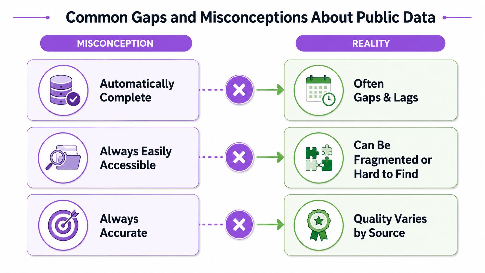
Common Gaps and Misconceptions About Public Data
Public data can look complete until someone tries to use it for a specific decision. Then the missing pieces become obvious, and the actual work starts.
Public does not mean complete
One common mistake is assuming public data captures the full picture. It often does not. Some community datasets update only on a slow cycle, which makes them a weak substitute for current operational judgment.
The practical answer is triangulation. If one source changes slowly, analysts can pair it with planning records, operator disclosures, or other public traces, then label the gaps instead of hiding them. That keeps the dataset useful without pretending it is more complete than it is.
Public does not mean neutral
Another mistake is assuming public data represents everyone equally. Equity research shows that communities can stay invisible when agencies do not collect, standardize, or publish data at the right level of detail, and those collection gaps can leave underserved groups out of view (equity and data gaps).
That matters in local planning, health, and infrastructure work because missing detail is not random. It often clusters around the same places and groups, so a dataset can look orderly while still missing exactly the areas that matter most.
More sources are not always better
A third misconception is that adding more public sources automatically improves the result. Without provenance, licensing, and freshness metadata, extra records can create noise instead of clarity. The analyst's job is not to collect everything, but to collect what can be defended.
That means tagging each record by origin, access condition, and refresh cadence before it enters the workflow. It also means keeping the source trail visible, because some public records are useful only when their limits are clear. Teams also need to check the terms that govern public use before republishing or modeling anything from the public record.
Putting Public Data to Work Responsibly
Responsible use starts with a simple sequence. First, define the decision the data has to support. Then find the most authoritative public source, check the access terms, normalize the schema, and capture provenance before anything is republished or modeled.
That workflow matters because public data is a long-term asset, not a one-off download. The Census has shown how continuity can anchor decisions for decades, while open-government rules like the terms that govern public use remind teams that access alone doesn't remove responsibility.
A good public-data product keeps the source trail visible, the gaps honest, and the labels consistent. That's how directories, dashboards, and market-intelligence tools stay useful after the first publish.
If a team needs a living example of public data turned into a searchable product, Data Centers List shows how facility records can be organized, labeled, and mapped for real-world analysis. Visit Data Centers List to see how public information becomes a directory that people can work with.